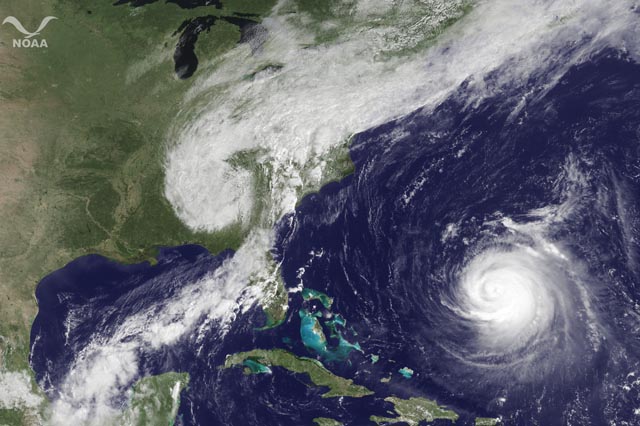
Emily in particular defied all the models. She passed below us as a tropical depression then became a tropical storm, stalling 90 miles south of Port au Prince and hovering there for 24 hours, leaving everyone in suspense as to whether she would wipe out the people living in tents. No computer model predicted this bizarre halt. In Dr. Masters words, "this motion or lack thereof is still something the models aren't analyzing well."
Here is a patois tweet from Haiti as Emily finally made her dramatic move north and spared the fragile city, dissipating over Santo Domingo.
@Apach_laLilianne Dupoux
Le'm di nou ti bout te sa yo rele #HAITI a ce nan plat main bon Dieu li chita kap travay sou li!Li we nou pat ka pren#Emily, li epargne nou!Google translation:
Le'm tell us little that was known # Haiti to dip in main dish best God sat working on it! He saw we could not take # Emily, she spared us!
@MinnickJay
Thank you for praying for Haiti, if you did. No hurricane, not even rainstorms. They are very happy.via TweetDeck
~
Next item of note: Tropical storm Harvey made landfall in Dangriga, Belize. Dandriga’s name meaning is ‘sweet water is close at hand’. I read that as ‘more magical excitement coming up!’
Irene was supposed to hit North Carolina as a cat 3, but degenerated quickly to a cat 1. Snippet readers must of sucked a stairway to heaven because her eyewall collapsed when she was forecast to strengthen - at practically the same hour I posted a blog about Morehead city and excused myself in order to get busy... 5:40 am. Her rains hit hard but the east coast and NYC were spared the science fiction scenario.
Here's Dr. Masters again: "Satellite data and measurements from the Hurricane Hunters show that Irene continues to weaken... Figure 1. MODIS satellite image of Hurricane Irene taken at 11:50 am EDT Friday August 26, when Irene was a Category 2 hurricane with 105 mph winds. The eyewall collapsed several hours before this image was taken, and no eye is apparent."
At 2:00 am on his previous post, Dr. Masters had written:
"Irene is forecast to make landfall on the North Carolina coast Saturday afternoon. It will likely be a Category 3 storm, with wind speeds around 115 mph.
~
...And Katia passed north of us as a tropical storm and only sent gorgeous waves. As a powerful cat 3 with a brief intensity to 4, she weaves artfully and is expected to avoid all land. I guess that’s what Dandriga’s ‘sweet water ahead’ was alluding to!

